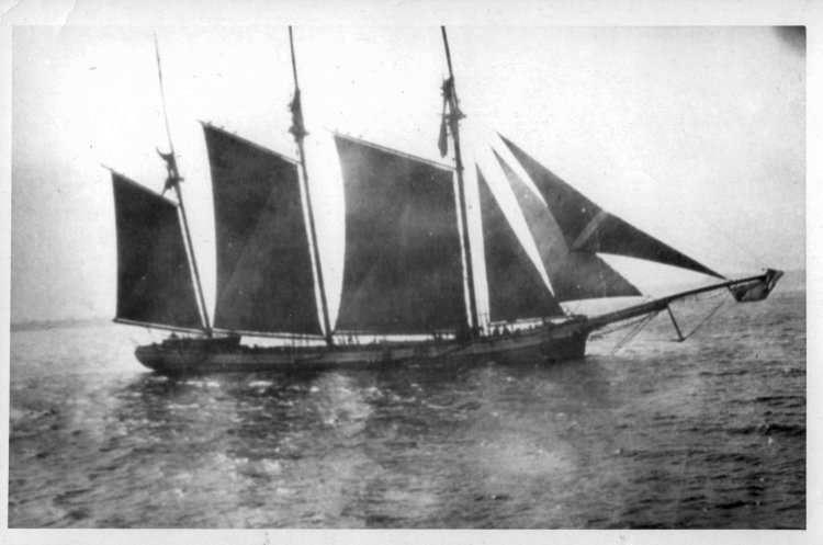
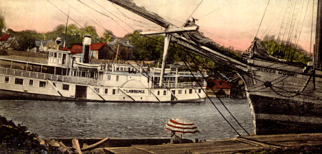
Cover Photo: Painting of the OLIVER MOWAT docked in Mill Haven, Ontario
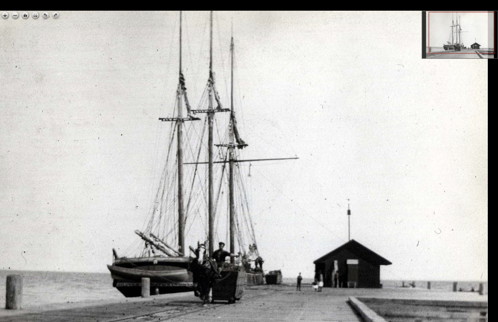
The morning of July 16, 1873 dawned bright and clear over the Mill Haven Shipyards as the passenger steamers began arriving from nearby Kingston, Ontario bearing the guests for the day’s historic launch.
The excitement of the crowd of over three thousand grew as Sir Oliver Mowat took to the stage to witness the christening of the three-masted schooner named after himself.
Along the wooden slides, the shipwrights were proudly standing at attention to watch their crowning achievement glide down into her element. They had put their heart and soul into her design since she was the first ship to be built at this new shipyard and would represent the finest of the era of wind and sail. The crew of the OLIVER MOWAT cheered as Miss Helen Fraser broke the traditional wine bottle across her bow marking the start of her journey into history.
OLIVER MOWAT – Photo Credit – The Maritime History of the Great Lakes
Schooners were the workhorses of the age transporting everything from raw materials to finished goods between centers of commerce around the Great Lakes. Maritime heritage played a key role in Canada’s development but is often overlooked in the history books.
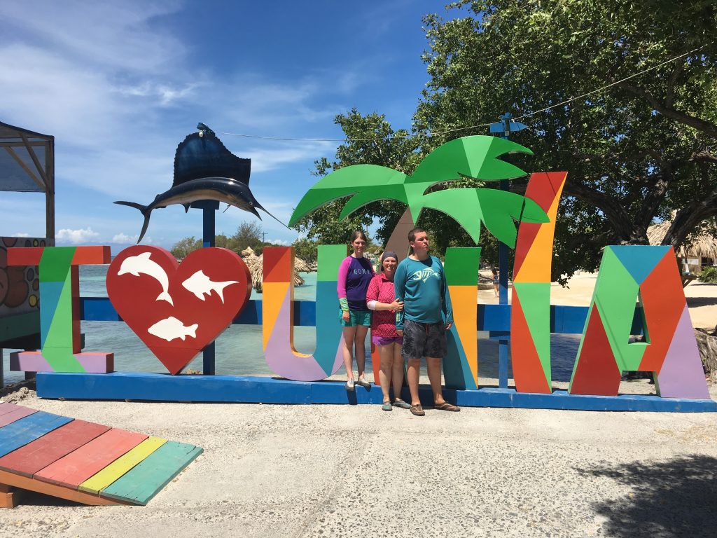
One of the goals of The Royal Canadian Geographical Society is to help Canadians better understand their country and its place in the world. The RCGS has funded this expedition to descend into the frozen depths of Lake Ontario and explore the time capsule of history hidden beneath the waves!
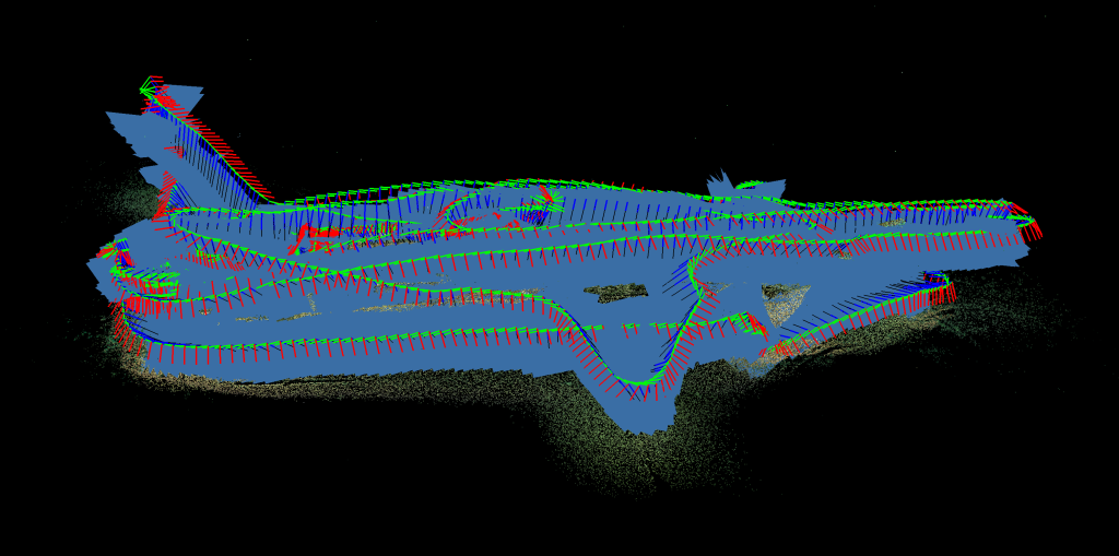
Cover Photo: 3D Photogrammetry Model of the KATIE ECCLES
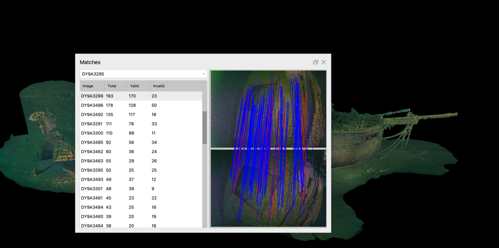
In exploring and documenting the OLIVER MOWAT, one of my goals is to create a 3D Photogrammetry Model. A detailed model will be a key element in the official archaeology report that will be sent to the Ministry and available to the public for research.
While I joke that photogrammetry is the art of taking thousands of really bad photos it is actually all about math. The technique dates back as early as 1480 with Leonardo da Vinci’s research on perspective. The modern version started in 1867 and was called Die “Photomatomic photography” and was the start of three-dimensional measurements from two-dimensional data. The first software was created in 1929: It was used for mapping and called “Stereoplan”. Developed by a German engineer it used satellite imagery and revolutionized photogrammetry, allowing for the creation of accurate maps and 3D models on a global scale.
The modern software available today is much more powerful and sophisticated and is capable of rendering very detailed models which can be rotated and viewed from any angle. To achieve this quality, you need to capture thousands upon thousands of overlapping high resolution photos that cover every inch of the wreck.
While the team has already captured hundreds of artistic photos during the expedition, none of these are usable. Photogrammetry requires photos that are close and very squared up, plus are brightly lit to the point of almost being washed out and overlap the next photo by fifty percent.
Planned Route to Film Photogrammetry Model
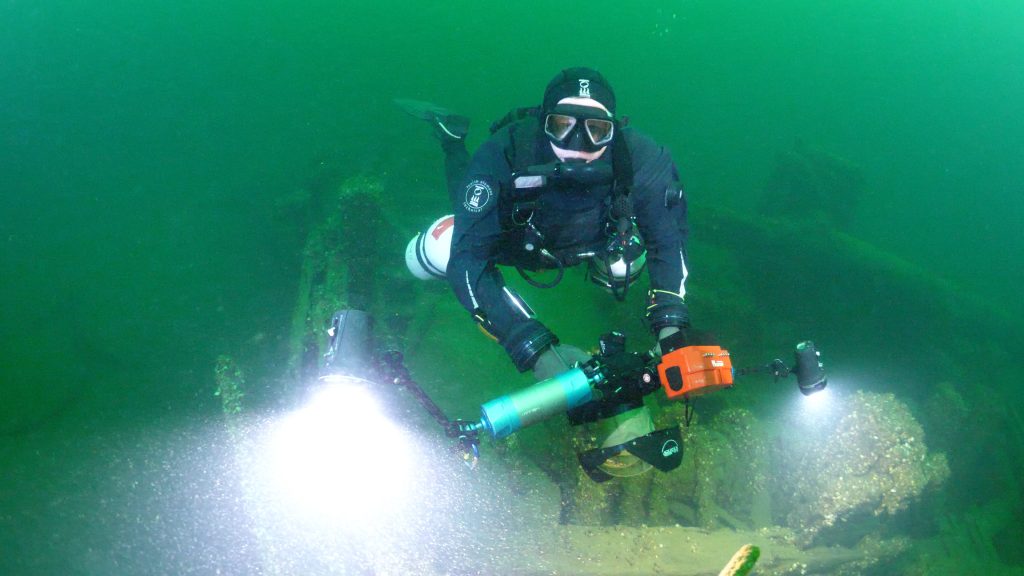
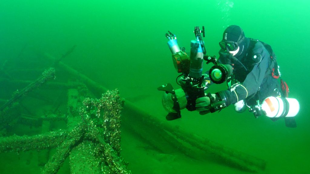
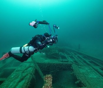
To capture this data requires a very carefully planned dive that will ensure every inch of the wreck was covered. The best results are achieved if all of the photos are captured on the same day so that the lighting is consistent. To do this the plan involved two teammates. The first diver would use a camera mounted on a scooter with four large flood lights. The diver will circle the wreck three times working slowly from the bottom up to photograph the sides of the hull with the overlap required. Then make several passes across the deck to connect the sides of the hull to the top. While this sounds easy, remember that time is limited at these depths and every minute counts, so an exact path was laid out in advance. Plus, it is important to keep the camera at the same distance from the wreck at all times which is VERY challenging when circling elements like the bowsprit, masts and crow’s nest. The second diver again had a very carefully planned route across the desk to capture the fine detail of the working components of a Great Lakes Schooner. Starting at the stern a spiral pattern is used to film the ship’s wheel from every angle. From there working towards the bow, this procedure was repeated for each of the other elements like the capstan, winch, donkey boiler, fife rail and windlass.
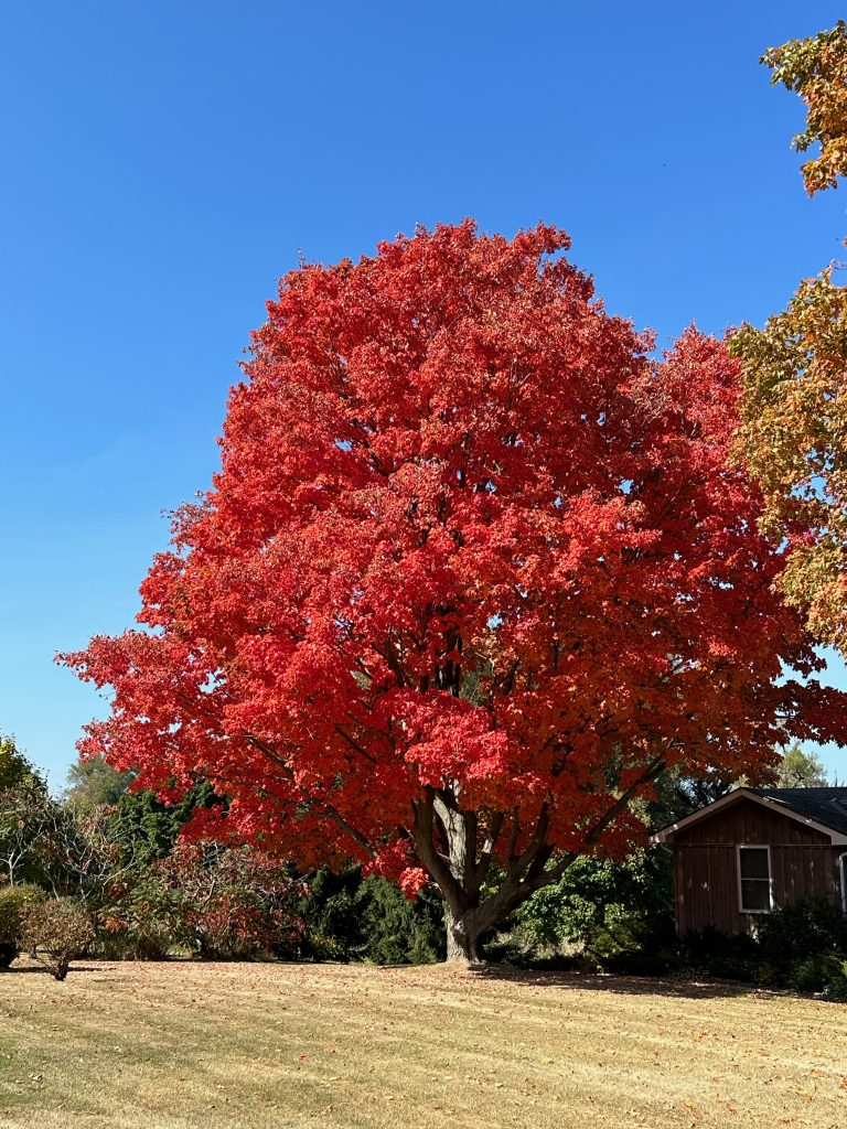
Fall Colours in Picton
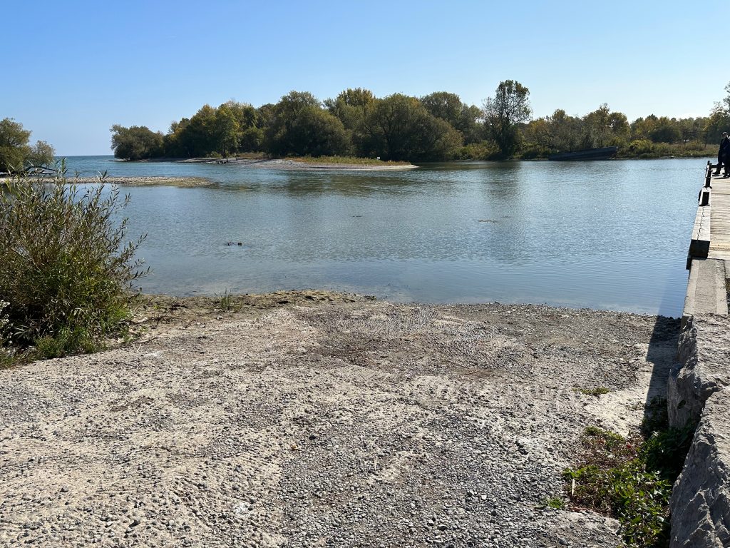
Late fall in Prince Edward County is a scene right out of a post card. The trees are ablaze of colour as you pass vineyards with farmers busy harvesting their crops. Arriving at our usual launch point, we were shocked as the habour looked more like a marsh. The water level was down a full two feet leaving the boat ramp high and dry with mud and rocks exposed.
Launch Ramp at Point Edward
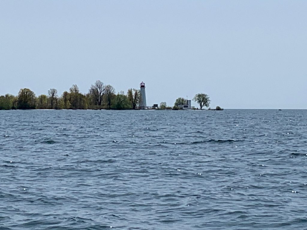
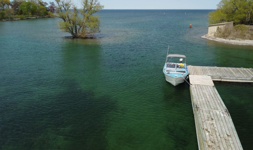
With a perfect day of blue sky and no wind, we were determined to get out to the wreck somehow, so we attempted to launch, but had to abort when the sterndrive started to sink into the mud. Not willing to accept defeat we came up with a new plan and headed off to the marina at the small town of Waupoos. Launching from this location would add an additional ten kilometers to the wreck, but with the water flat and calm the trip was achievable. After successfully launching the boat and loading up the equipment, I enjoyed the feeling of sun on my face and wind in my hair as we skimmed across the waves. Passing False Duck Island, I could imagine what sailors were feeling a hundred years ago as they headed out onto the lake with just a map and compass to navigate to ports far away.
Lighthouse on False Duck Island
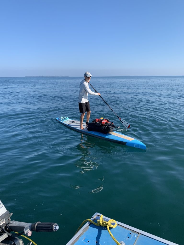
At the site as we geared up to start our dive, we were shocked to see a paddleboarder approaching our boat. What was he doing here twenty-five kilometers offshore in the middle of the lake? Pulling up alongside us, he wanted to check if we had broken down and needed help since he had never seen small boats out this far. After assuring him that we were fine, we enquired about his story. He explained that over the last several years he has been slowly circumnavigating Lake Ontario. Each trip he would pick up from where he left off, exploring both the shoreline and islands along the way. He was heading out to Main Duck Island where he planned to camp for the night. As he departed, we wished him well and warned him about the snakes that he was sure to encounter on his adventure. WOW, you never know what you will experience as you explore the waters of Lake Ontario.
Visitor on the Lake
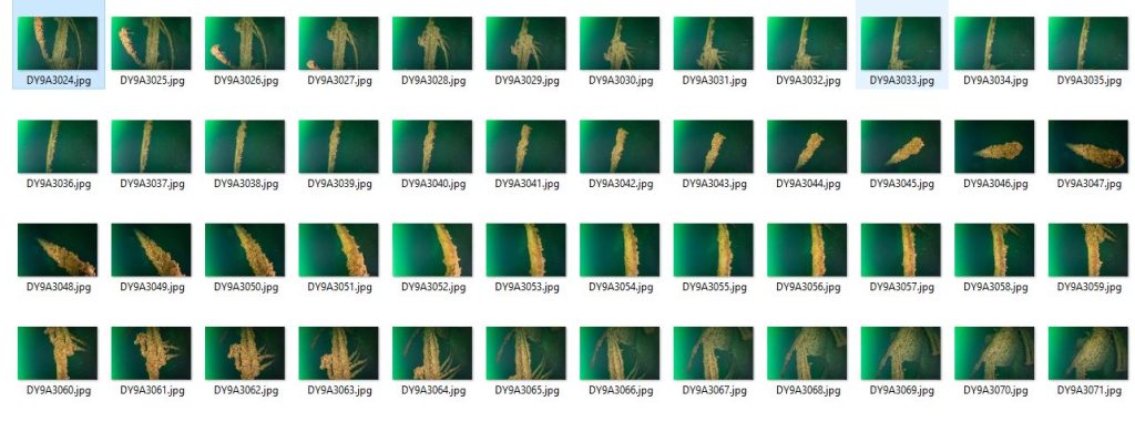
With the lake flat calm, we headed down the shotline to capture our photos. An hour later we were ecstatic as we climbed back onboard that the dive had gone perfectly to plan. With the sun sinking in the sky, we turned and started the long cruise back to shore. Anxious to see the results, we checked the cameras and were relieved to see that we had captured over eleven thousand photos.
Kayla Preparing to DiveScooter Rigged for Photogrammetry
The following day I started the long process of turning these photos into a 3D Model. Even with a very powerful computer, the procedure will require several weeks of non-stop computing since we are creating a 4K resolution model. The software will create forty thousand data points on each photo and then compare each photo to the other eleven thousand in order to stitch them together. After colour correcting the photos and importing them into the software, I had to patiently wait for two days for the first step to complete. When the alignment process finished, I was thrilled to see that I had achieved 97.7% accuracy. YES, we captured great photos!
3D Photogrammetry Model
Click HERE to view the interactive 3D model on https://3dshipwrecks.org/. Producing this type of model allows the public to explore the OLIVER MOWAT without having to dive into the cold depths of Lake Ontario.
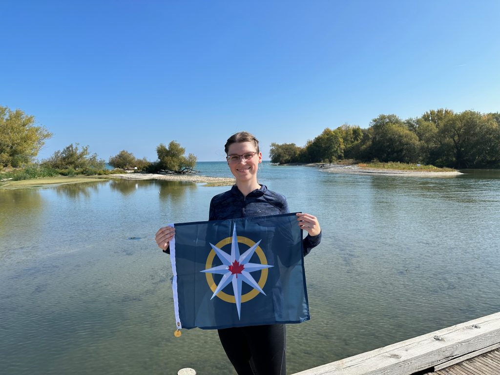
Kayla Holding RCGS Flag Number 24
It has been my honour to have been selected as a 2023 Royal Canadian Geographical Society Expedition Grantee and to lead my team members, Jill Heinerth and Charlotte Pilon-McCullough on this expedition. Over the next several months, we will be sharing the story of our expedition at conferences, dive shows and in publications. Sharing the story of the OLIVER MOWAT, The Era of Wind and Sail to the public will be our reward for all of the long hours underwater and hard work over the season!
We are able to positively identify the wreck as the OLIVER MOWAT due to an overwhelming amount of evidence
The wreck lies close to the coordinates listed in the official records
It is a three masted schooner of the correct length and beam
The impact point precisely matches the historical collision report
The masts have clearly been dynamited down as recorded in newspaper articles
Anchors are still in place and match photos found in archives
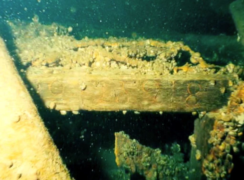
Even with all of this evidence, historians are always looking for absolute proof by finding either the name somewhere on the wreck or tonnage markings which are unique to each ship.
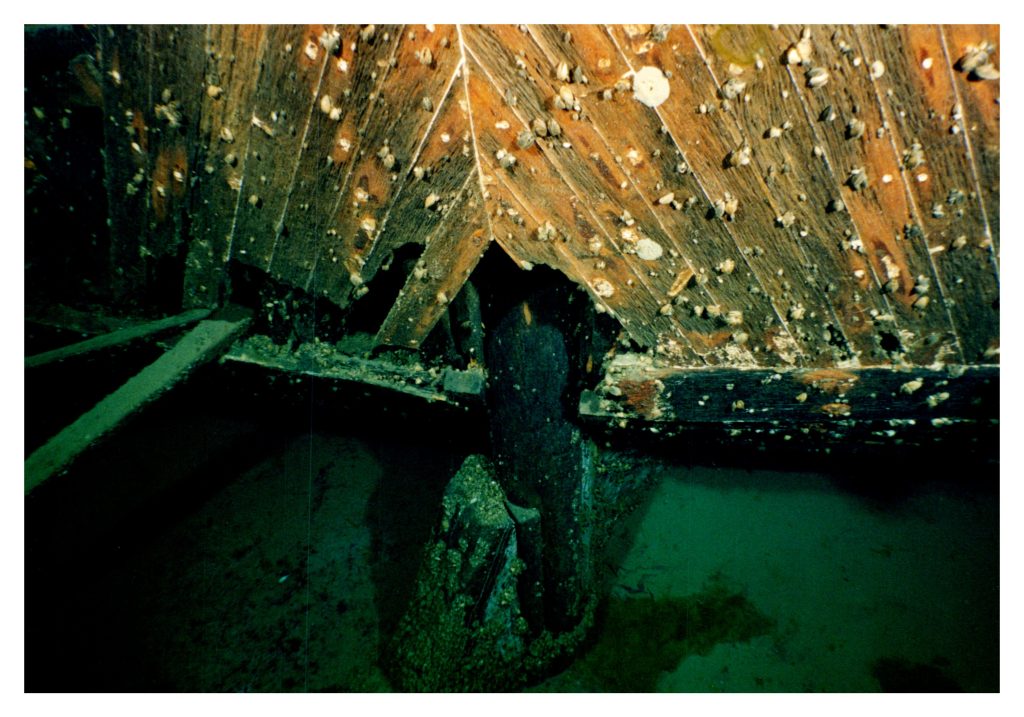
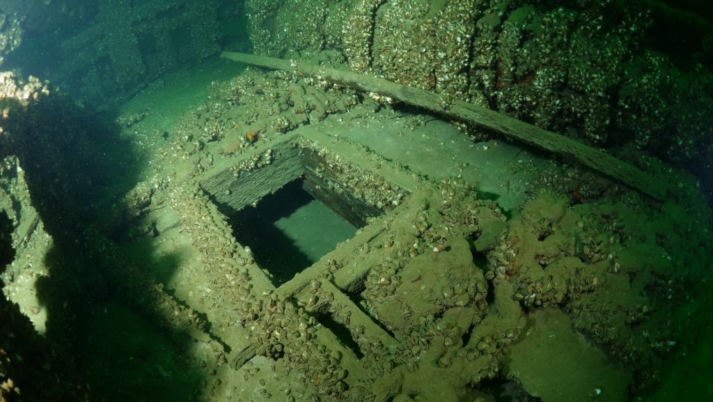
Registration Numbers on the Hold of THE CITY OF SHEBOYGAN
After a ship is launched, it undergoes an official inspection in order to register it. This involves listing its dimensions, features and calculating its cargo capacity. The official tonnage numbers are very important so are usually carved into one of the boards on the foremost cargo hold opening. They are used throughout the ship’s career for a variety of purposes from calculating the cost of passage through canals to the amount of income for the quantity of cargo carried.
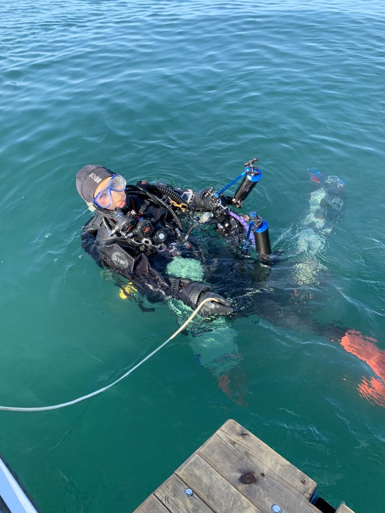
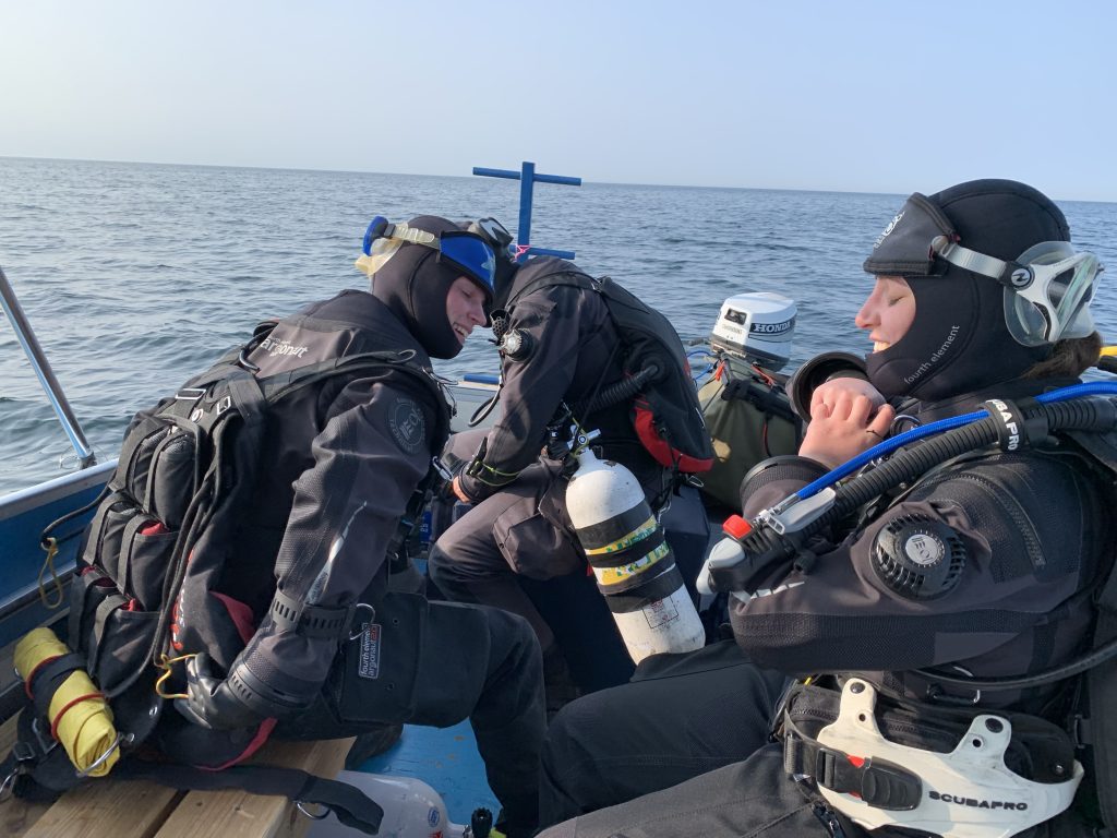
Jill and I have an exact sequence of preparing and entering the water. This routine ensures that we have checked everything and are fully prepared for a safe dive. After gearing up, Jill enters the water first and then the captain passes her the camera. Then I proceed with my final gear up while Jill makes her way to the shotline. Then as I was about to enter the water, Jill suddenly returned calling out to quickly get her camera out of the water. As the captain grabbed it, I was anxious since I could hear the alarm going off. This was quickly replaced by relief as I heard Jill shout out, “don’t worry I am sure that it has not flooded, the alarm is singling a loss of vacuum”. Since Jill was already in the water and I was prepared to go, we decided to continue with the dive which would be a historic moment of Jill not carrying a camera.
Jill Without a CameraJill Spotlighting the Winch
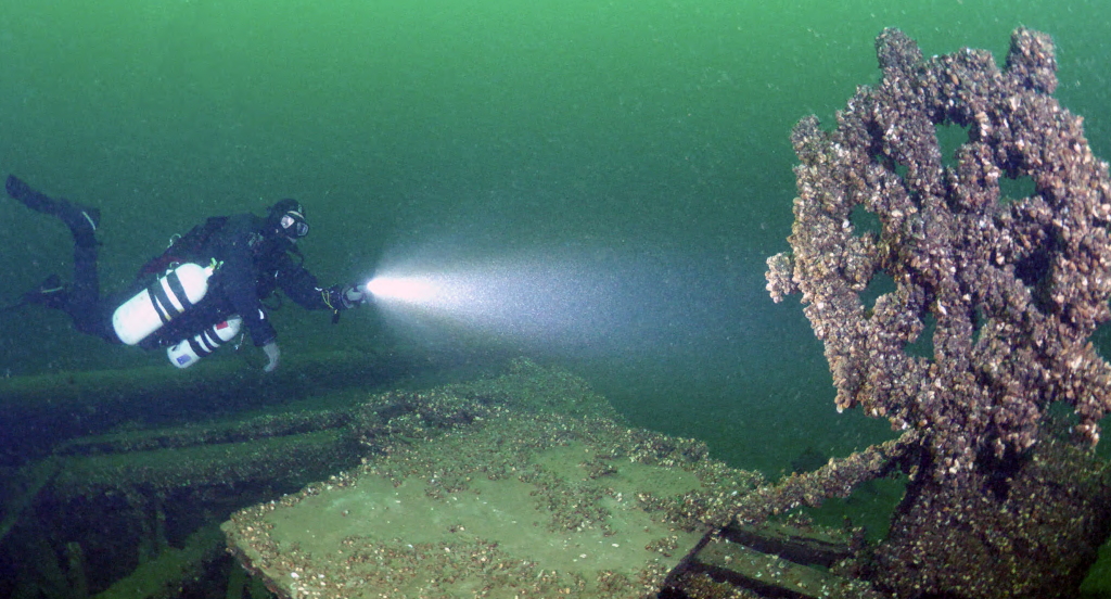
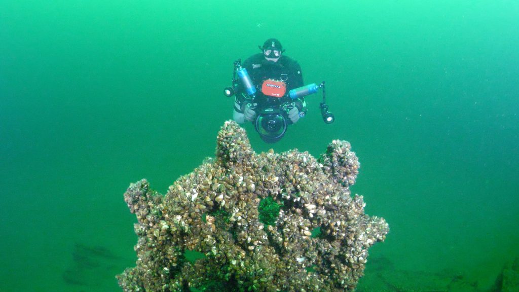
Upon reaching the bottom Jill headed directly toward the forward hold opening, while I captured some rare photos of her without a camera. Jill then carefully examined all of the timbers looking for the tonnage numbers, but with so many Quagga Mussels covering the surface she was unable to locate them. Many divers may be tempted to scrape them off but in doing so damage the wreck. Mussels attach themselves with a series of byssus threads which burrow into the wood. In addition, their waste products are acidic which further weakens the wood. By removing the mussels, you tear off a layer of wood off of the wreck. Divers should always practice low impact diving by never disturbing the layer of mussels on shipwrecks.
Jill Examining the Forward Cargo Hold
Unable to find the markings, we headed to the stern to look for the name which we found in a historical photo painted across the lower transom. When the wreck was first discovered, the stern was fully intact and the name was likely visible, but time and the weight of so many mussels has caused it to collapse. Searching the fallen timbers, our hope was to find some of the name still visible, but again this evidence alluded us since the boards were face down in the slit and our archaeology permit does not allow us to disturb the site in any way.
There are photographers and models and rarely are the roles reversed. As I am sure many of you can relate, when I look back at our family photos, I can see how my mother, brother and I enjoyed the experiences, but it is hard to find a single photo of my father. He was our designated photographer of the family and as such rarely appears in any photos. The same holds true for many expeditions. In our team, Jill’s photography work is world renowned and her equipment is the best that is available. This has naturally put her as the lead photographer in our group.
With Charlotte unable to dive this weekend, I changed the goals of the dive to focus on capturing photos of Jill in action documenting the wreck and proving that SHE WAS HERE!
Jill Filming AnchorJill’s Camera SetupJill Over Windlass
Jill in Action on the OLIVER MOWAT
It wasn’t easy to convince Jill to stop shooting and turn off her lights so that I could capture a photo of her next to the ships wheel.
There is a lot of planning required for an expedition, for every minute underwater several hours of preparation and logistics are needed.
It was June 4th since the entire team last dove together and June 18th since I dove with just Jill. Weather and other commitments have prevented the expedition from moving forward. Waking up at 4am I was excited that the weekend was coming together. The whole team was available and the weather was looking perfect. Heading out with the sun rising I was planning out the dive in my head as I spent the four hours driving to Picton. Driving up to the dock I was greeted by similes and hugs from Charlotte and Jill who had arrived before me and already had their gear unloaded and lined up on the dock. Together we quickly launched the boat, loaded the gear, went over the safety plan and the objectives of the dive. With the lake still as glass, we were expecting a quick trip out so we put on our dry suits and boarded the boat.
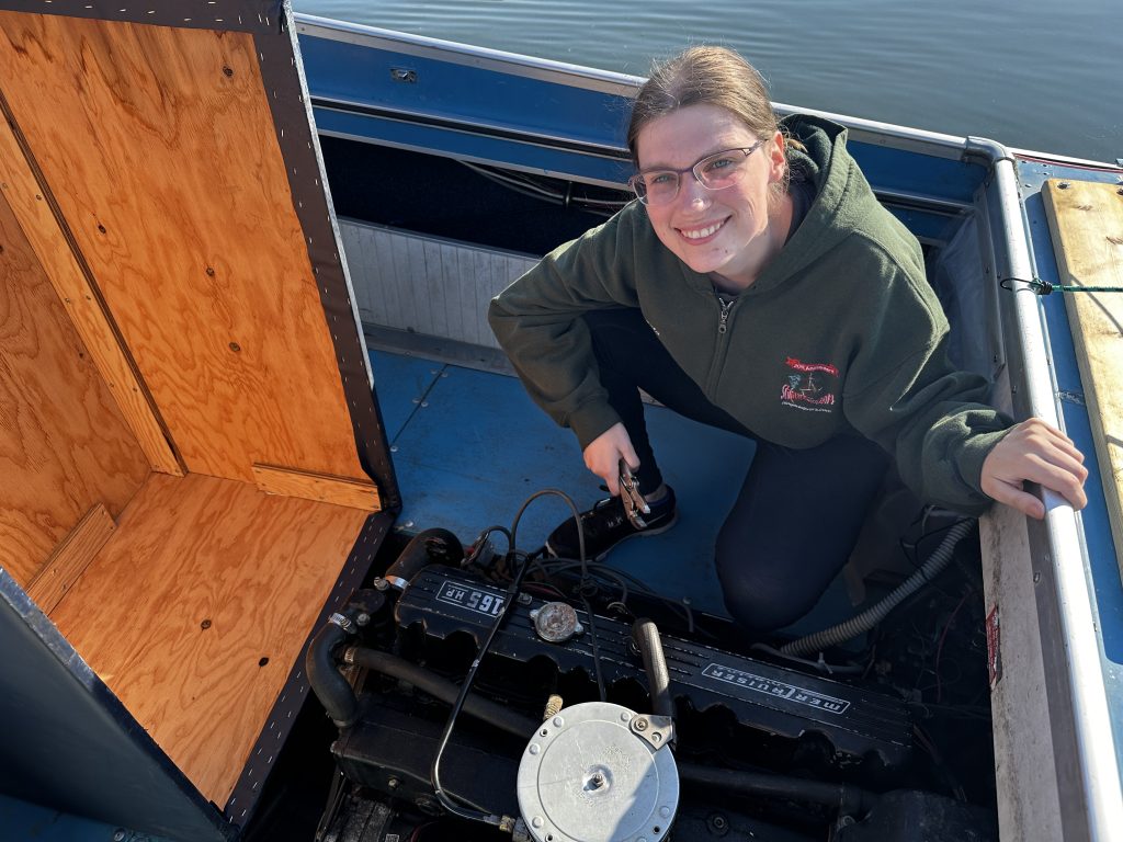
THEN, murphy showed up… the boat would not start.
This is not our first rodeo so we did not panic and proceeded to break open the tool kit and spares that we bring along for just such an occasion. Long story short after an hour of working on the engine we troubleshooted the issue down to a faulty fuel supply valve. The switch was locked in the middle and was not providing gas from either the port or starboard tank to the engine. While we can fix a lot on the water, changing out fuel lines and valves is not something that we were prepared to do.
Kayla troubleshooting the engine
So, we unloaded all the gear and pulled the boat and since we were all together spent the next few hours reviewing the storyline for the documentary and preparing a list of the remaining photos that we still needed.
As we were saying goodbye, Jill pointed out “If it was easy, it would have already been done”.
Since the Fabulous Four discovered it, a small select group of divers have explored this wreck over the years for their own enjoyment but have never documented the condition and artifacts. As the first true archaeology expedition since its initial discovery, this survey work is very important; when we document a shipwreck, it gives us a snapshot in time and an inventory of the significant assets. When those assets are catalogued and shared with the public, the social pressures of protection are shifted to the whole diving community. This assists in protecting Canada’s extraordinary marine heritage for generations to come.
With Charlotte being unavailable this day, our goals were for me to catalogue the artifacts that are present on the wreck while Jill would film action shots of this phase of our expedition. Let me share with you a small selection of some of the key elements that make up a three masted Great Lake’s schooner.
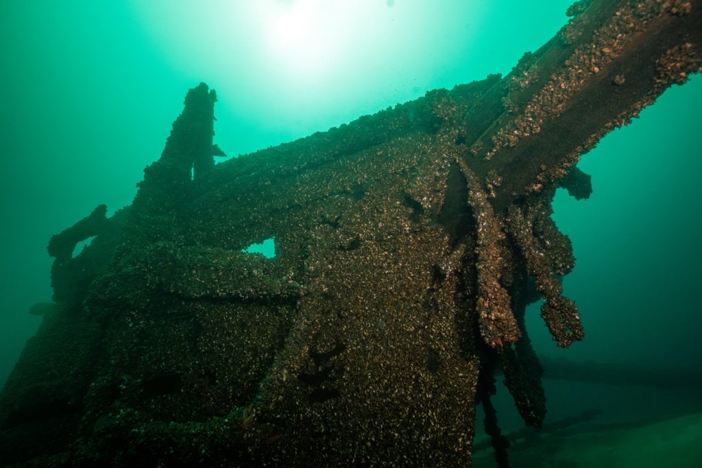
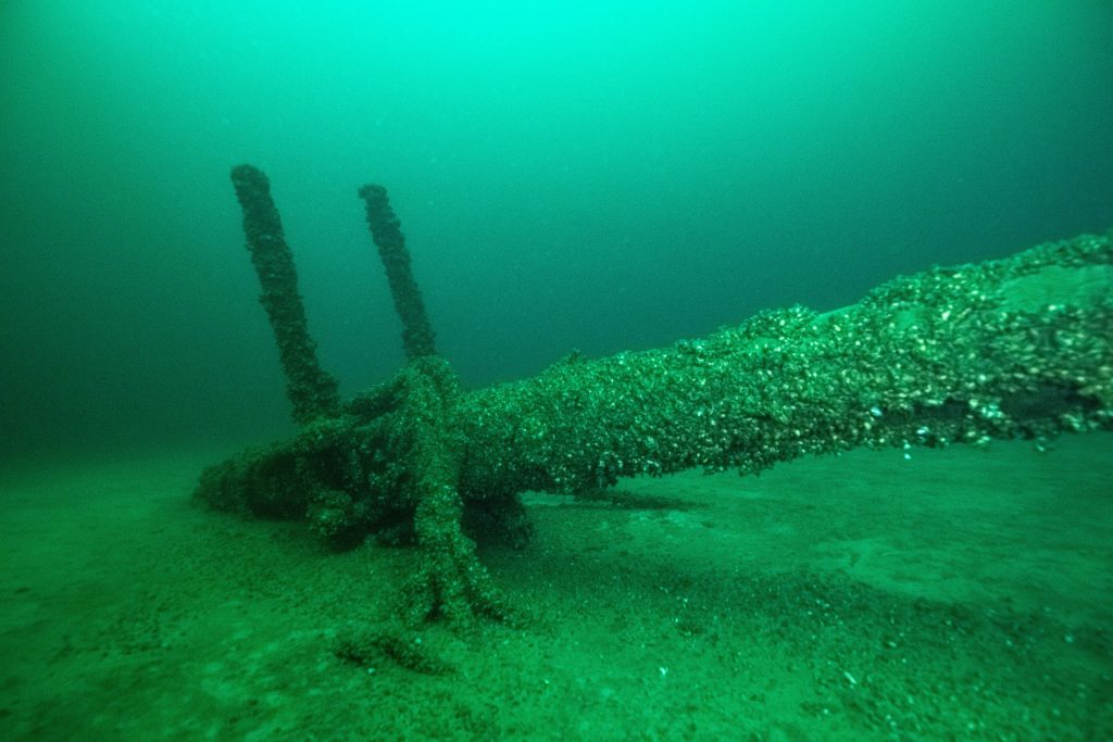
Bow with Hanging Anchors
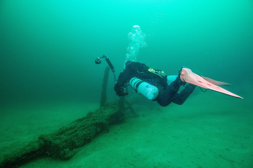
We started our cataloging at the bow. While I was focused on the windlass and chain locker, Jill was able to capture an outstanding photo of the bowsprit and hanging anchors.
Chain Locker and WindlassJill Documenting Bow
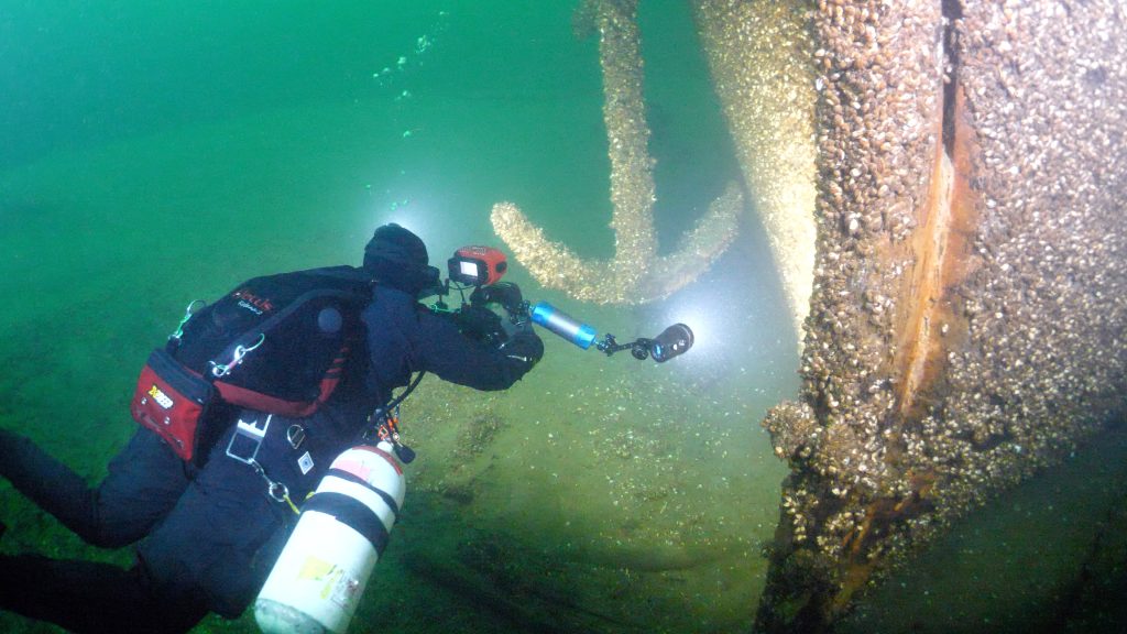
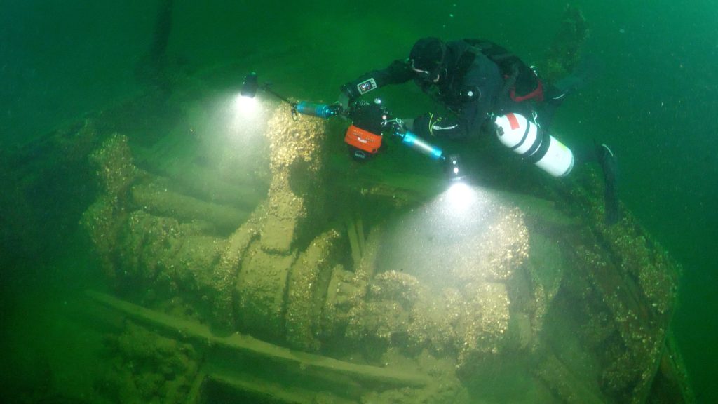
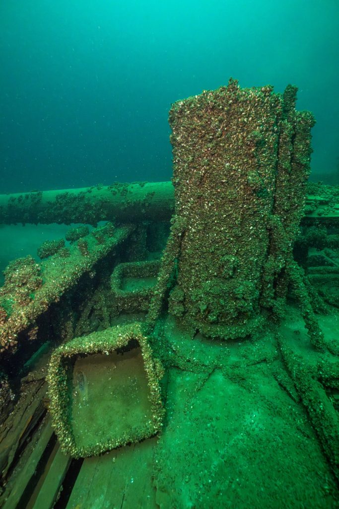
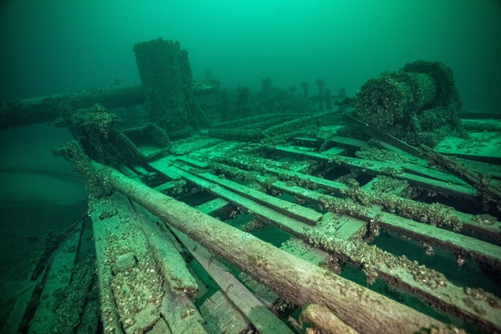
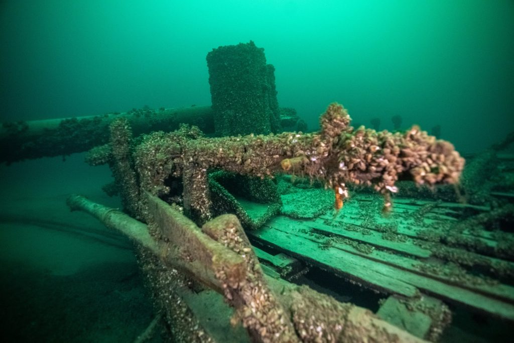
One of most noticeable features of the wreck is a massive donkey boiler standing over three meters tall positioned just aft of the fallen foremast on the port side. Lying just in front of it is an ash bucket that would have been used to pull the spent hot ashes out of the boiler while safely preventing them from coming in contact with the wooden deck. Conveniently positioned between the boiler and port side rail is a coal bin that would have held fresh fuel to stoke the boiler.
Donkey Boiler
While I slowly swam along the 30 meters of foremast to reach the crow’s nest, I recalled the series of tragic events that led to the collision. Had the lookout not left his post from the very spot I am looking at, the Oliver Mowat may have continued her career and would eventually be dismantled and we would never have the opportunity to explore her.
Cover Photo: Jill filming Kayla and Charlotte loading boat
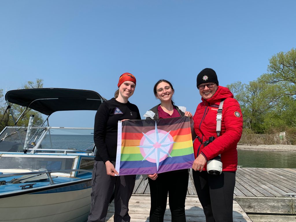
Kayla, Charlotte and Jill with RCGS Pride Flag on Main Duck Island
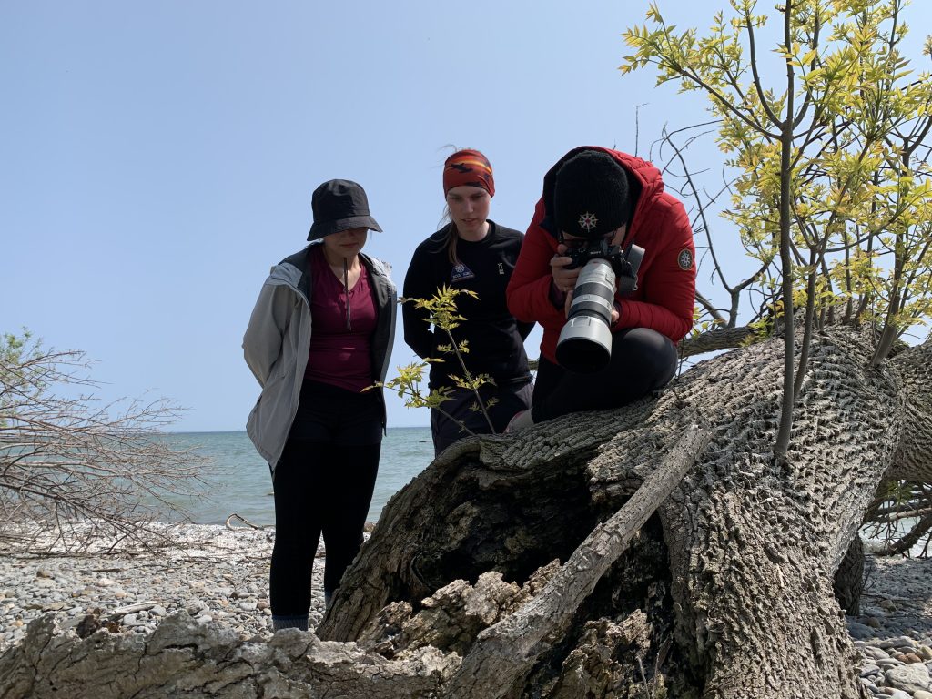
When watching a documentary many viewers believe that all of it was filmed as it happened. Reality is very different! Whether climbing a mountain or diving a shipwreck, the expedition team members are focused on capturing the moment in spectacular sequences and images. While these shots are important, what is also critical in creating a film are the cutaway shots which are also known as B-roll footage. Cutaway shots are panoramic location photos, weather, close ups of flora and fauna and expedition preparation like loading gear. These small bits of video or photos are used to tie the key scenes together and transition between segments in the storyline.
Dive FlagFilming on Main Duck IslandKayla Capturing Close Ups
On perfect weather days, the team is focused on getting out to the wreck and spending as much time underwater as possible. The cutaways are filmed on days that are too rough to dive or during the surface intervals that we are required to take for safety before returning to the depths on scuba.
Jill Filming CharlotteJill Filming Kayla
This morning the wind was blowing at 35 kms per hour and gusting to over 50 and the waves had built up to almost a meter. Since diving was out of the question, we spent the day reenacting parts of the expedition in order to capture the cutaway shots that would be needed. The three of us require an immense amount of gear to spend a whole day out on the water. Watching us load a hundred items into the boat for over half an hour would make for a very boring video, so we filmed it in time lapse to only take 25 seconds. We then headed out to a small, sheltered bay where we recreated diving scenes like jumping off of the boat or starting our descent to the wreck. When these are used in the film the audience will not notice that the bottom was just three meters below vs the thirty meters that the OLIVER MOWAT is really resting in.
Kayla Climbing LadderFourth Element GirlsReenacting Decent
Hopefully I have not shattered your belief in documentaries by sharing what goes on behind the camera, but I wanted to provide you with the full experience and effort that is required to mount an expedition for the Royal Canadian Geographical Society.
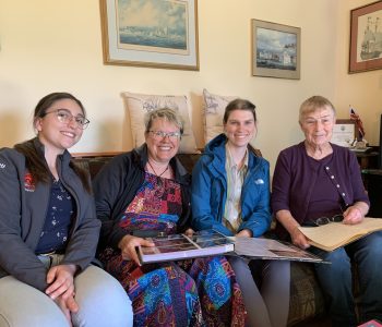
Cover Photo: Charlotte, Jill and Kayla visiting Barbara Carson
Barbara Carson and Lloyd Shales
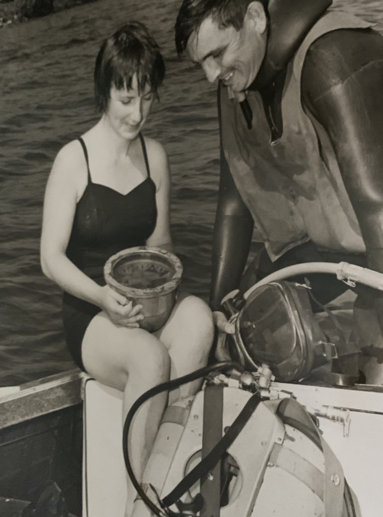
One of the most influential women that has inspired me to dive is Barbara Carson. She is a legend in the Great Lakes Shipwreck diving community.
Growing up in the fifties, Barbara heard many shipwrecks tales and was driven to explore for herself beneath the waves. When her cousin Lloyd Shales started selling the first scuba gear in the area, Barbara trained herself to dive and over the next several years dove shipwrecks in the region.
In 1963 the YMCA started a scuba diving training program, Barbara who had already been diving for many years, decided that these “C-Cards” may take off one day, so she decided to get certified. The irony is that she had more experience than her instructor.
Now certified, she started researching the archives of old Kingston newspapers in hopes of identifying areas to search, so that she could discover a wreck for herself. Barbara was very skilled in both research and boating, so it was just three short months later she would make her first discovery, The CITY OF SHEBOYGAN.
Over the years she would go on to discover many more, including The WILLIAM JAMIESON, The ALOHA, The GEORGE A. MARSH, The ANNIE FALCONER, The KATIE ECCLES and The bow section of the MONOLA.
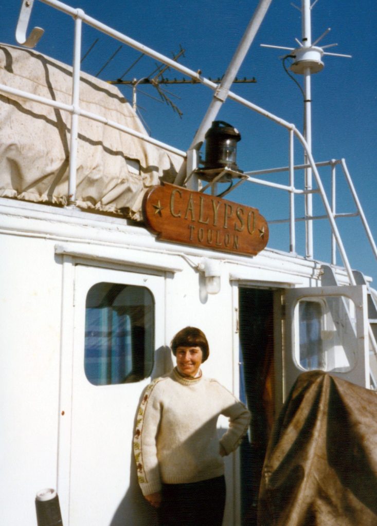
Barbara on deck of Calypso
One of her most significant discoveries, which took over ten years to identify, was the R.H.RAE. In 1976, Barbara along with her close friend Audrey Rushbrook were searching for the wreck of the BURT BARNES. They discovered an intact schooner which appeared to match the BURT BARNS but lacking a name board or bell, she was unable to confirm the identification.
After the dive, they decided to keep the location of the wreck secret in order to protect it. Barb and Audrey both were instrumental in the founding of the Marine Museum of the Great Lakes at Kingston, so they applied for and received the salvage rights from the Canadian Government. This allowed them to remove artifacts from the wreck with the purpose of putting them on display at the museum.
Plans were made for photographing and documenting the wreck, unfortunately Audrey became ill and passed away the following year, so the work of documenting the wreck was put on hold.
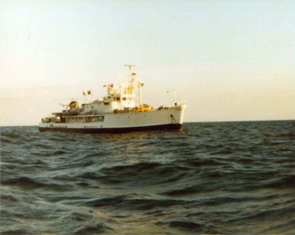
Several years later with the wreck still unidentified, Barbara learned that famed underwater explorer Jacques Cousteau would be visiting the Great Lakes, with his converted World War II Minesweeper the Calypso. He was planning to dive the famous 1812 shipwrecks of the HAMILTON and SCOURGE. Barbara made an offer to Cousteau via the Kingston Marine Museum, to explore her wreck. Her hope was to get access to the footage and photographs that would be taken in order to help with her research on the wreck.
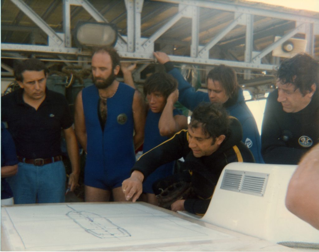
So on September 3, 1980 Barb Carson and Doug Pettingill meet the Calypso and lead the ship out to the wreck.
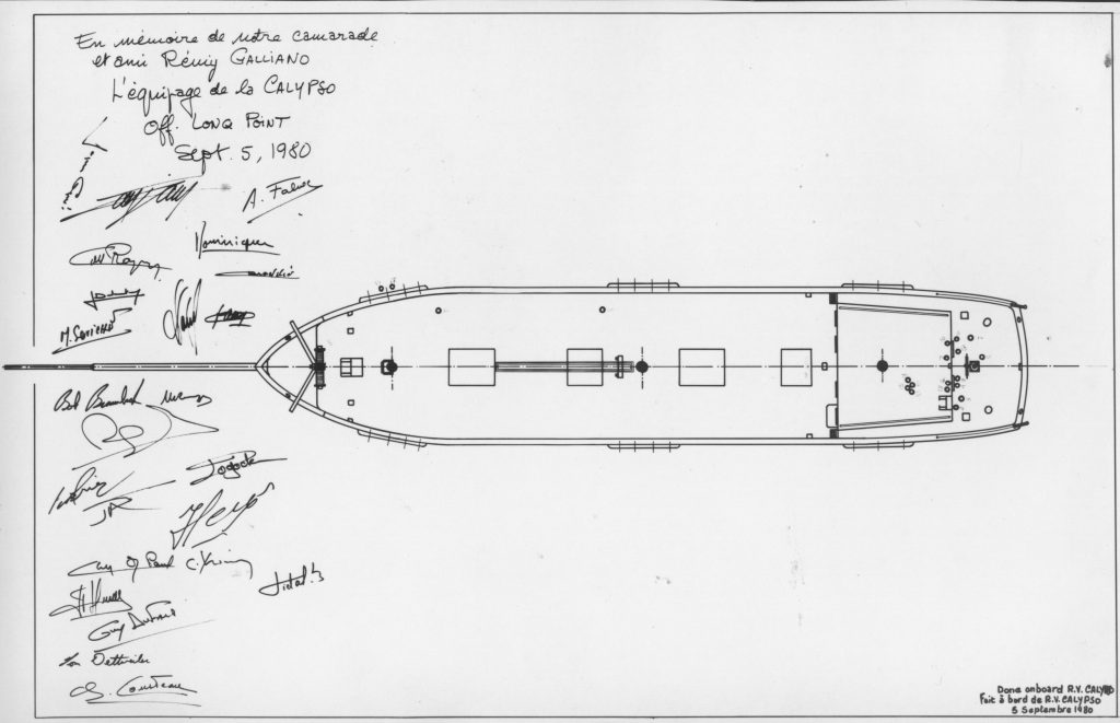
During the Cousteau dives, the ships wheel was removed along with many other artifacts that after conservation would be displayed at the Kingston Museum along with the site map that Barbara had the whole dive team sign,
CalypsoR H Rae Site MapCalypso Dive Team
Shortly after the Cousteau visit, Barbara became close friends with Rick Neilson who used the patent markings uncovered during the restoration of the wheel to continue the research.
It would take him another five years, but in the end he was able to positively identify the wreck as the R. H. RAE.
Barbara is a true diving legend and her passion for shipwreck exploration has left a legacy for generations to come.
Cover Photo: Charlotte and Kayla approaching the OLIVER MOWAT Wheel
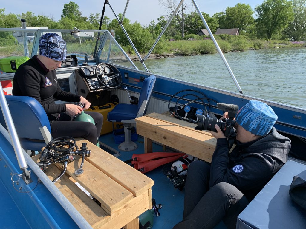
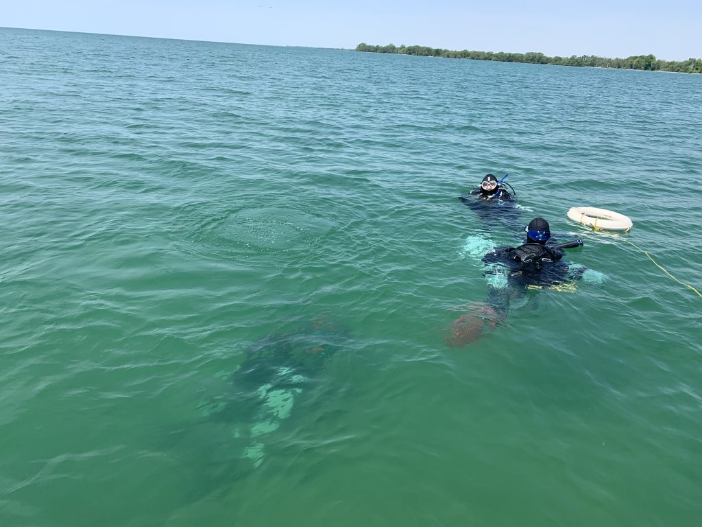
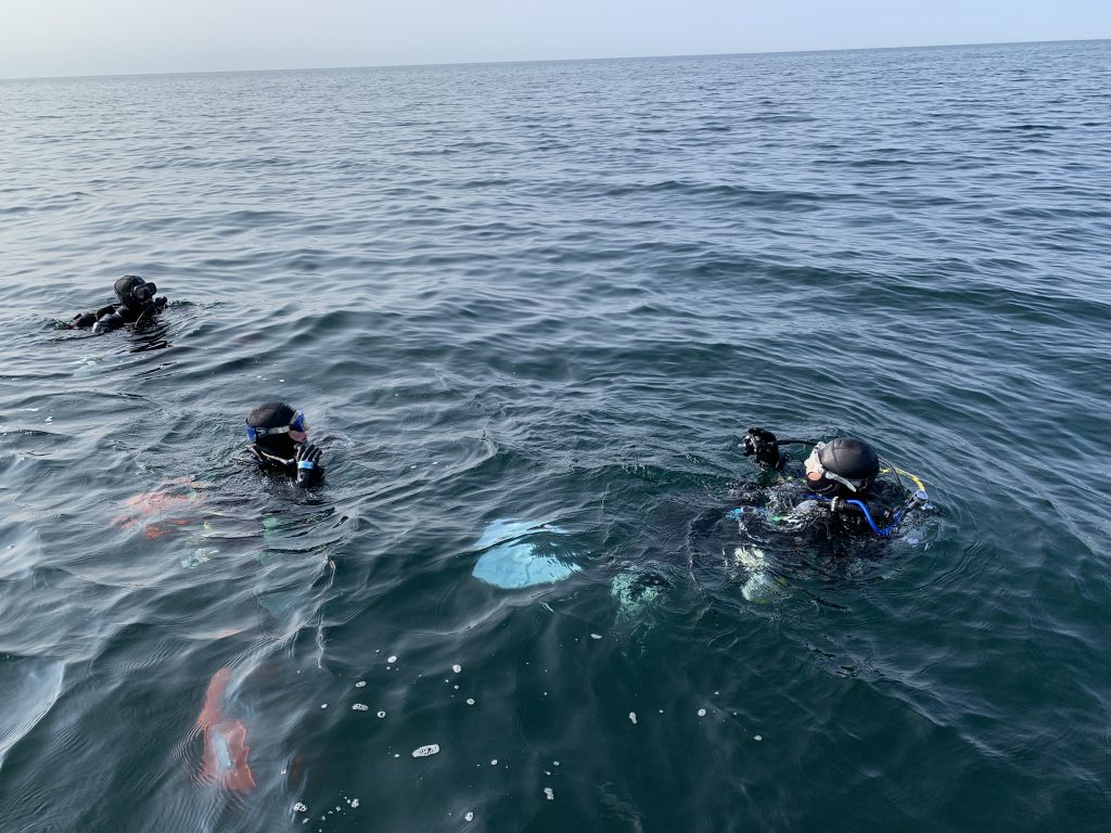
The weather pattern for the weekend was little to no wind overnight, then as the sun came up the wind and waves would slowly build all day. Based on this the team decided that the old saying “the early bird gets the worm” was the way to go. So, the plan was to get up at 5 am and be at the boat launch just after sunrise. Since everything was prepared the night before, we were able to quickly launch into water that was still as glass. With no waves, we had the advantage of increased speed, so we started gearing up as soon as we left the dock.
Charlotte, Kayla and Jill ready to launch
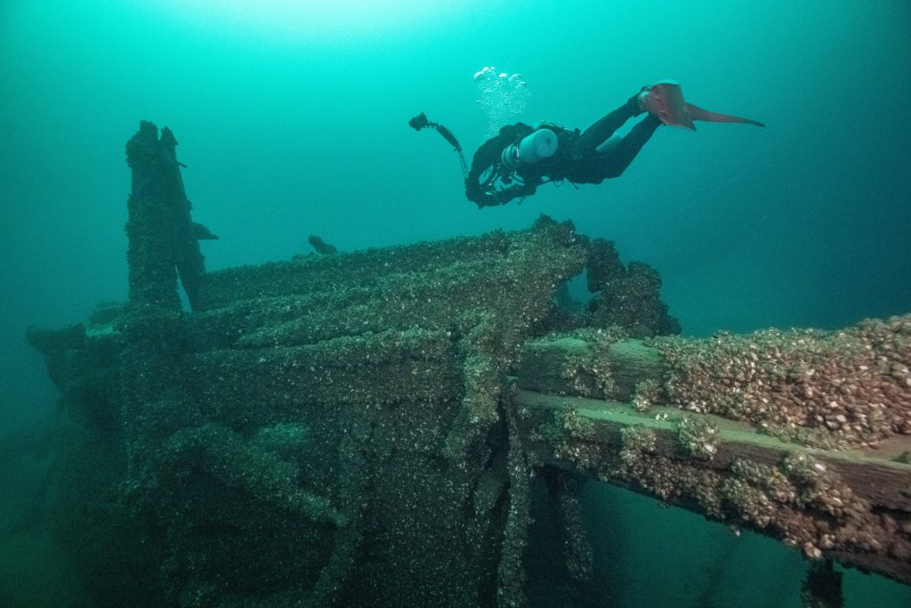
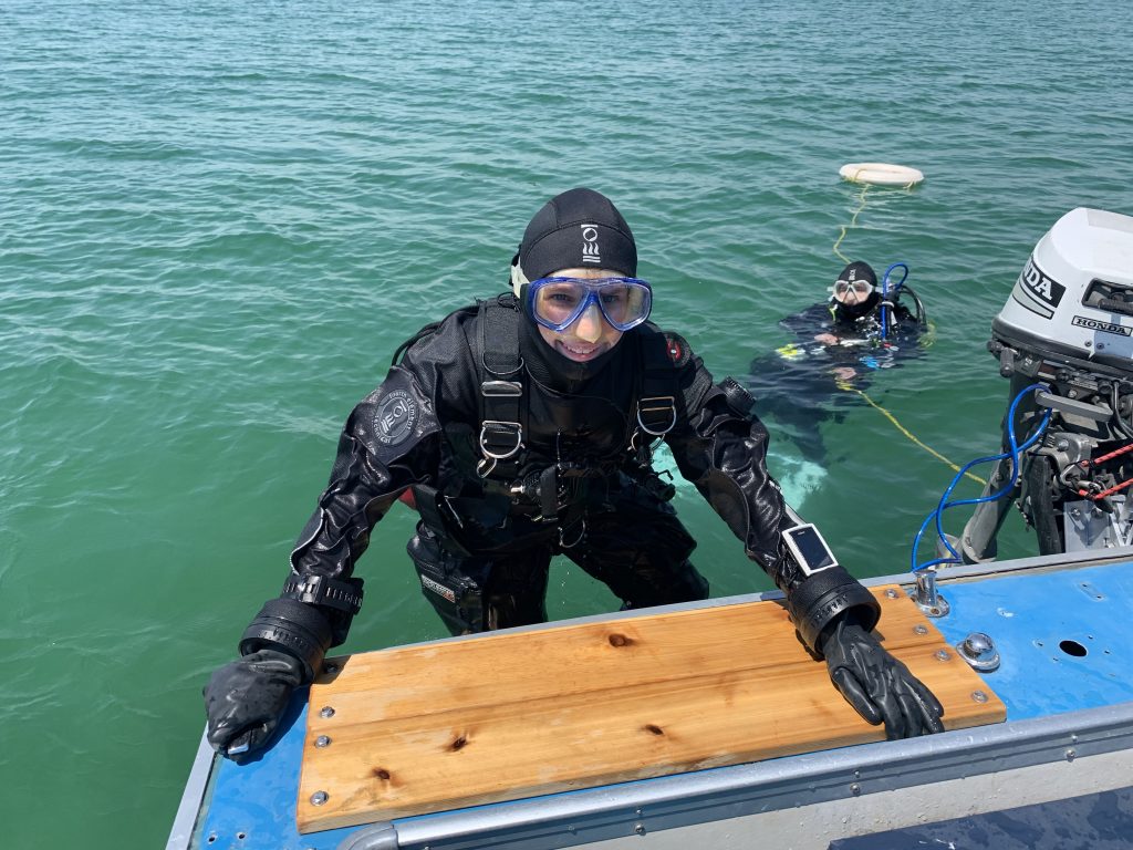
Arriving on site we deployed a new shotline and then proceeded to gear up as a team, carefully checking each other’s equipment which we would be depending on in the cold dark depths below. As we entered the water, I was filled with anticipation of finally seeing the shipwreck that was beneath my fins. We descended as a group, following the shotline which was disappearing into the darkness below. It felt like I was sinking forever, then suddenly I had a cold shiver run down my spine as I thought about that fateful night just over one hundred years ago which claimed the lives of three crew members and sealed the fate of the OLIVER MOWAT.
Team Members Gearing UpPreparing for their First Decent
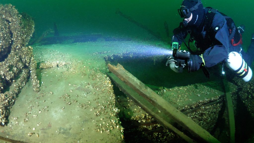
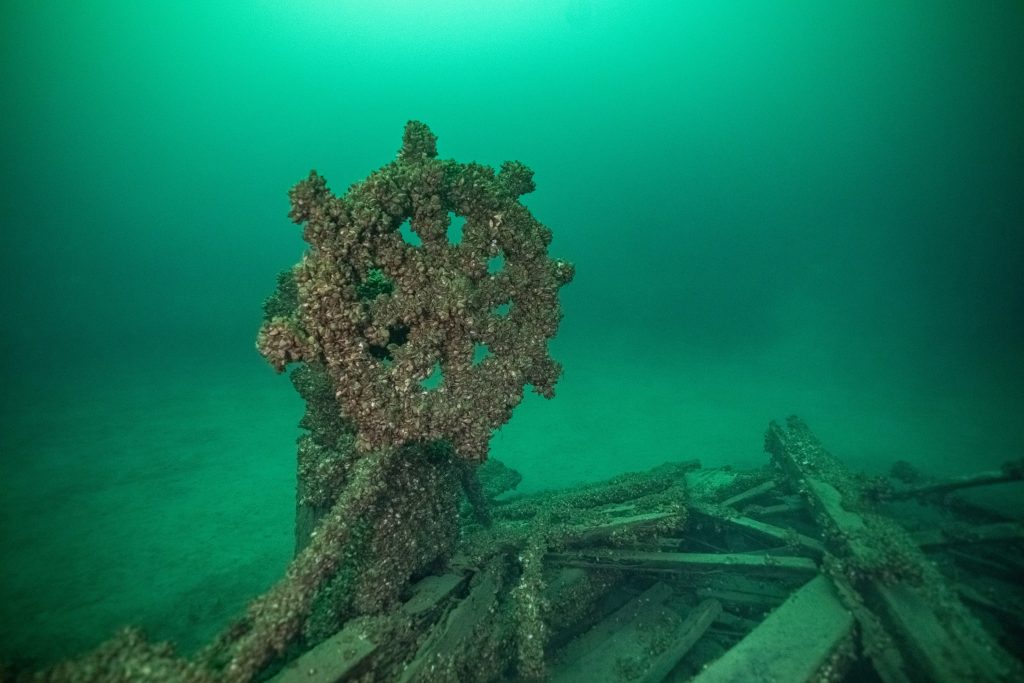
This sobering thought vanished as suddenly a shape appeared out of the gloom beneath me, then as I descended the remaining fifteen meters the visibility completely opened up and the ship’s wheel rose up before me. She is absolutely gorgeous and has lived up to the tales that I had heard from the Fabulous Four. The shot line had actually landed on the decking, so we carefully moved it off into mud ten meters away from the wreck so there was no potential entanglement hazard.
First View of the OLIVER MOWAT
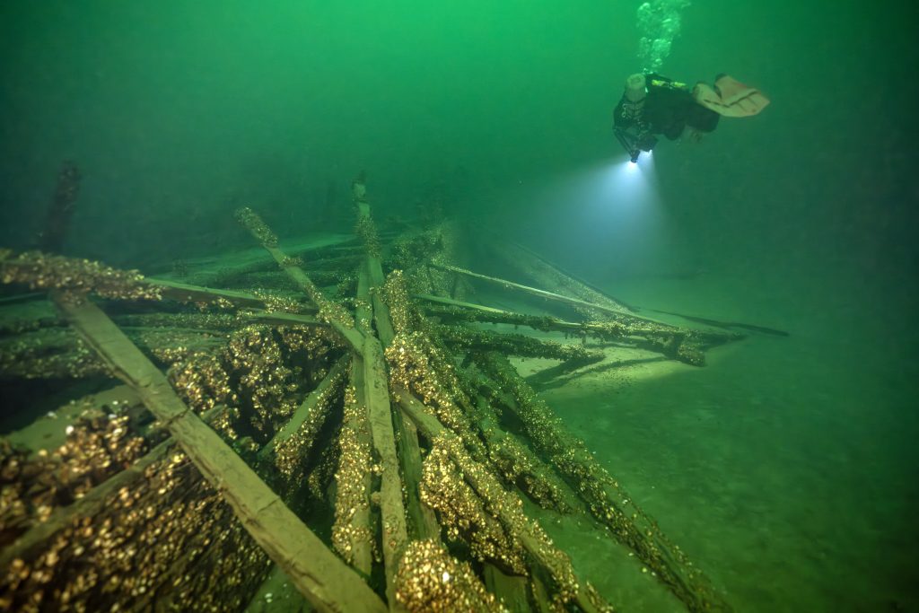
Glancing at my wrist mounted dive computers, I noted we were 37 meters down and knew at this depth the no decompression dive limit would be just a short fourteen minutes. So, with time being of the essence we each proceeded to our pre-planned assigned tasks. Our goal for this first dive was a complete preliminary survey of the wreck from bow to stern to establish its condition. While Jill started to capture images, Charlotte and I took out our waterproof sketch pads and started to document details as we proceeded to swim toward the bow forty meters away. Charlotte noted that the mizzenmast and mainmast were broken off and lying to the starboard side, with the foremast also broken off but laying to port with the crow’s nest still intact.
Heading toward the bow
Passing up the portside I was stunned by the size of the hole in the hull where the KEYWEST had collided with her. I could now understand how a schooner this large could sink in just four minutes. Arriving at the spectacular intact bowsprit, I noticed that we were just about to enter deco, so I signaled to my team to turn the dive and return to the shotline for our ascent back to the world above. Regrettably, taking photos of the bow would have to wait for the next dive. Again, we headed to the surface as a group, being careful not to touch the shotline; precision buoyancy would be critical during the ascent. During the five-minute safety stop at three meters I had time to reflect on what I had just experienced. The wreck was picture perfect, sitting completely upright, it was hard to believe that it had been resting on the bottom for over a century. Gliding across her deck had allowed me to slip back into time and for a moment it felt like I was part of the crew during the golden age of Great Lakes Schooners.
This will be a dive that I will remember for a lifetime!
The Expedition’s Perfect Moment
Back on board we could see the excitement reflected in each other’s eyes and we could not stop talking about what we had just experienced. Today was one of those Perfect Moments, the visibility was an exceptional 30 meters so capturing images would be the primary goal of the second dive. We would spend the next hour refining our dive plan based on our notes from the first dive to ensure that we would maximize every precious minute of bottom time to capture as many images as possible.
First Dive Completed
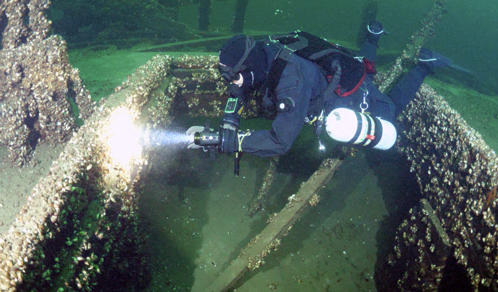
Now familiar with the site, the descent on the second dive went much faster, gaining us an additional precious minute to explore. On this dive we wanted to focus on the two most breathtaking features of the wreck, the bowsprit and the wheel. As we swam the length between them, we noticed many smaller details that we had missed on the first dive. The foremast fife rail was still intact, including a belaying pin. Fife rails circle the bottom of the masts and are usually destroyed when the masts are broken. Deadeyes were still lining the port and starboard rails; they would have been used to secure the rigging that held the masts upright. Near the bow was a coal fired donkey boiler which would have generated steam to power a winch to assist the crew.
Starboard Anchor and Donkey Boiler
With our goals for the dive achieved and team safety a primary concern, we reluctantly left the wreck as our computers signaled decompression was upon us. Looking down as we slowly ascended, the OLIVER MOWAT was swallowed up by the darkness and would be hidden from sight until the next time that we could return to uncover more of her secrets.
Cover Photo: The OLIVER MOWAT Expedition funded by The Royal Canadian Geographical Society
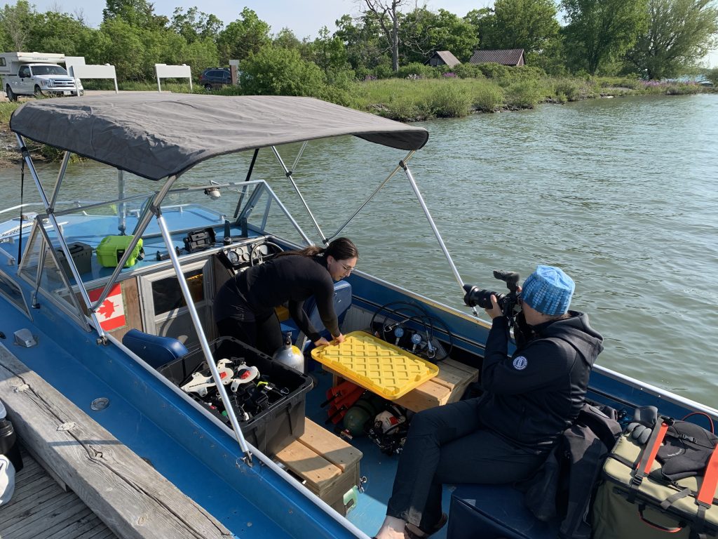
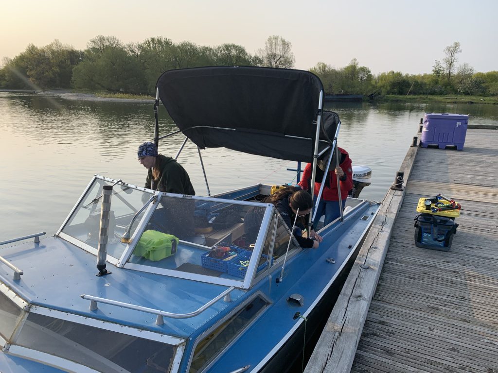
It is like I am stepping back in time as I pass picturesque farms on the way to the boat launch next to the historic lighthouse at Point Edward. The air is filled with the smell of lilacs which are in full bloom everywhere that I look. We quickly launched the boat, but it took another hour to review our check lists and load all of our cameras and diving equipment on board.
Prepping the boat for the Expedition
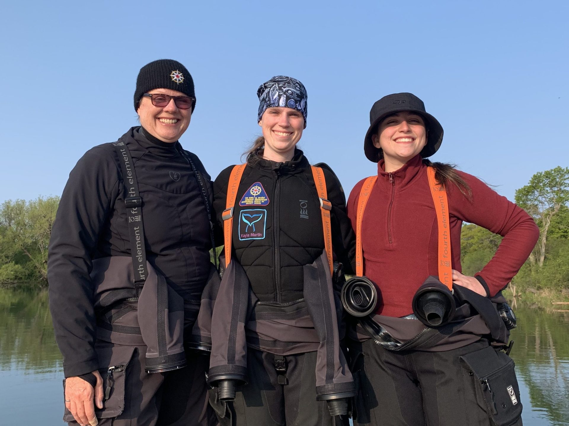
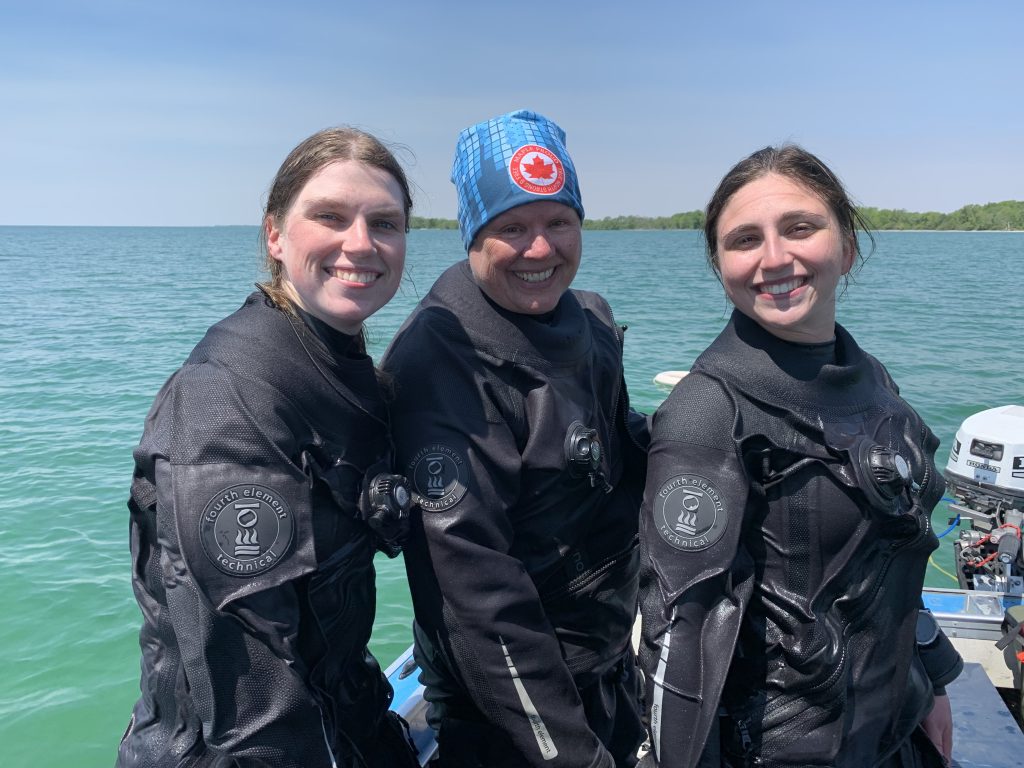
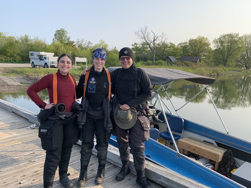
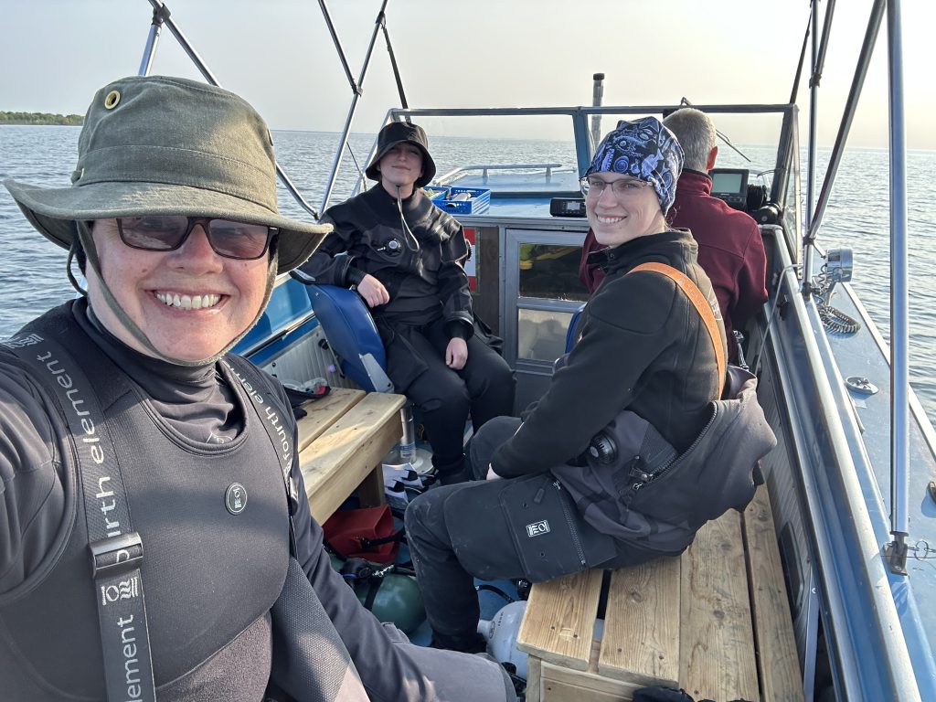
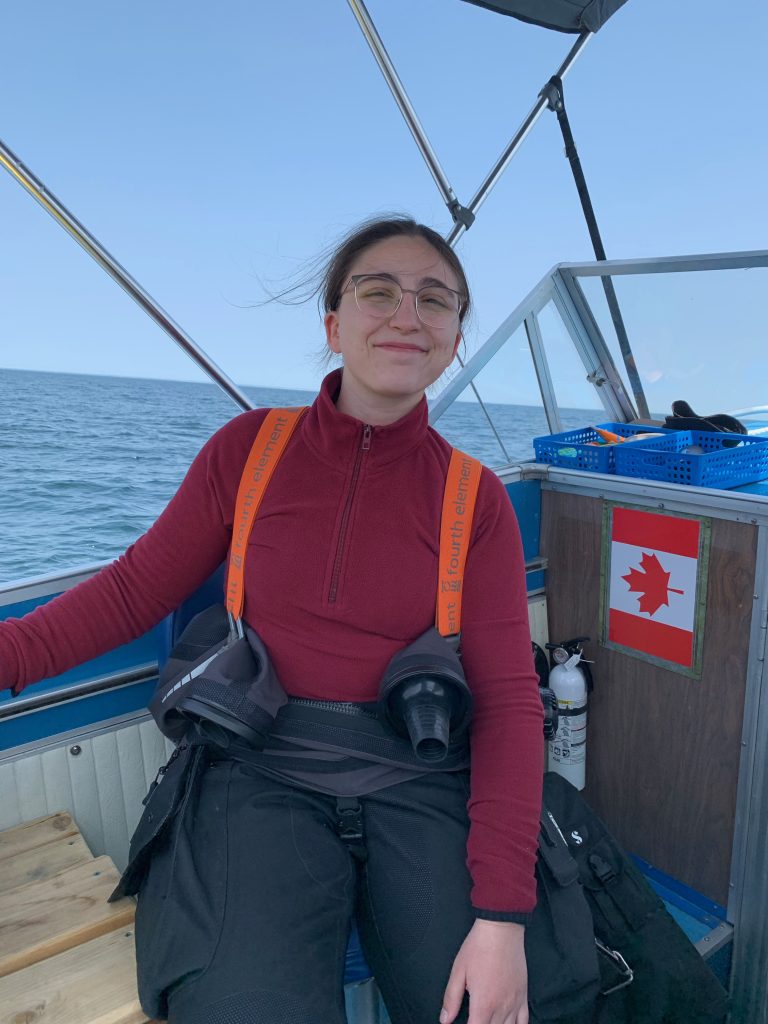
Lying almost fifteen kilometers offshore, the boat ride was expected to take about an hour. The feeling of the sun on my face and the wind in my hair added to the anticipation that had been building for months. Looking at my teammates beside me, I thought about how fortunate I was to have them onboard this expedition. Charlotte Pilon-McCullough is a third-year student studying biochemistry at the University of Ottawa, where her focus has been on conserving aquatic environments. Last summer she worked with Parks Canada as a member of the Thousand Islands National Park Resource Conservation Team and had spent considerable time on Main Duck Island which we are planning to explore over the summer. She has also spent extended periods on small commercial boats and has been working in the scuba industry over the last nine years at Kanata Diving Supply as a Divemaster.
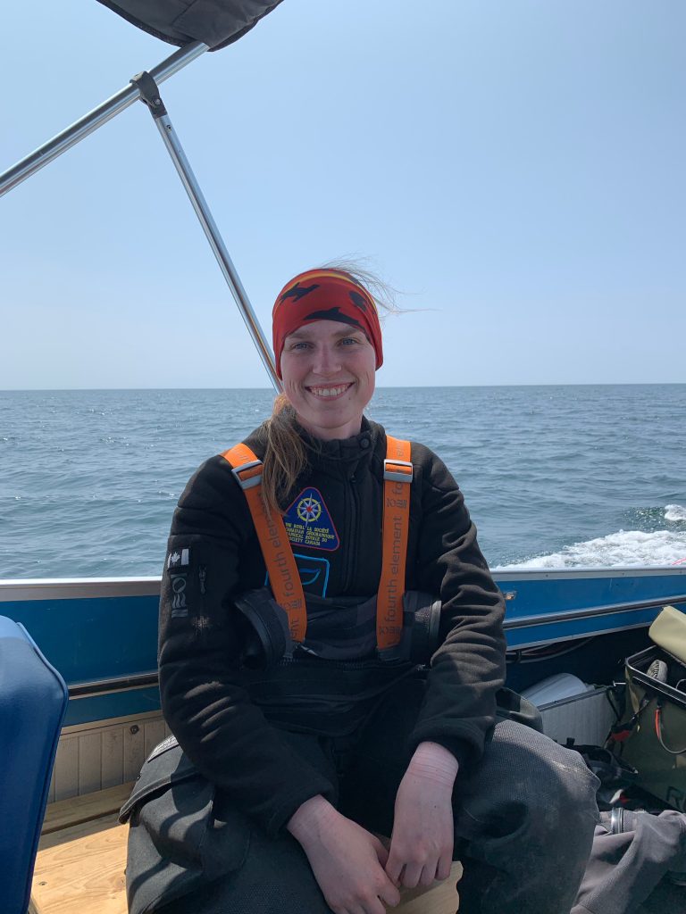
Jill Heinerth is the current Explorer-in-Residence for The Royal Canadian Geographical Society. More people have walked on the moon than visited many of the places that she has explored on Earth. From the most dangerous technical dives deep inside underwater caves to searching for never-before-seen ecosystems inside giant Antarctic icebergs, her curiosity and passion for our watery planet is the driving force of her life. Achievements include the Governor General’s Polar Medal and being appointed a Fellow of the International Scuba Diving Hall of Fame. In addition, the Explorers Club has recognized her work with the prestigious William Beebe Award for ocean exploration.
Charlotte Pilon-McCulloughKayla MartinJill Heinerth
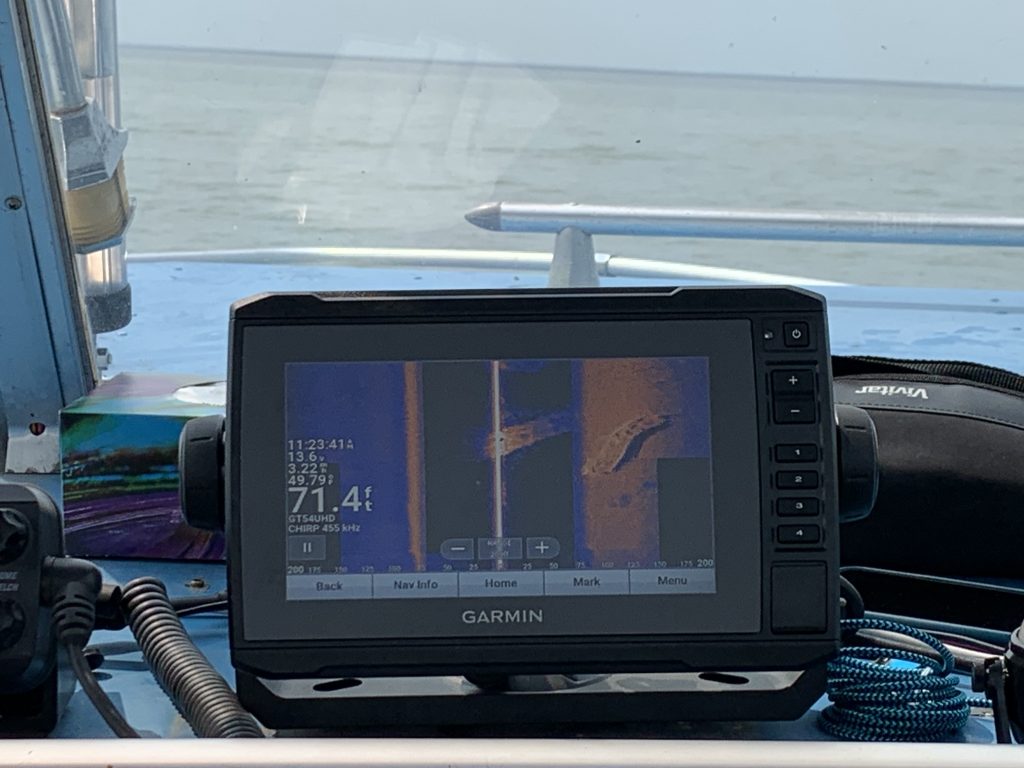
Nearing the general area of the wreck, we slowed down and activated our sidescan sonar to begin our search. A few minutes later we almost fell out of our seats in shock as the wreck appeared on the sonar screen on our very first pass!
First Image of the OLIVER MOWAT
WOW, we had planned for several hours of searching, but thanks to the amazing coordinates that Tim Legate and Spencer Shoniker had provided us, it was now time to go diving. After the cheers died down the next step was to mark the location with a shot line, so we circled back and deployed our first line successfully. However, during the time that we spent gearing up to dive, the waves had moved the shotline away from the wreck since we did not put a heavy enough weight on it for the conditions. We retrieved it and deployed it a second time with a heavier weight, but as it started to unroll the line jammed and the float was pulled under and never resurfaced. As we prepared to deploy our backup shot line, our boat Captain drew our attention to the increasing size of the waves which were now starting to build close to two feet. He then made the call to end diving for the day. With a smaller boat and the fact that there was no proper mooring it was unsafe to continue diving. Even though we were all disappointed that we were not going to explore the OLIVER MOWAT today, the team agreed that it was the right call and that it would be better and safer to dive the next day. With the sun still high in the sky, we decided it was time to follow in the footsteps of the Fabulous Four and venture to Main Duck Island.
The harbour at Main Duck Island
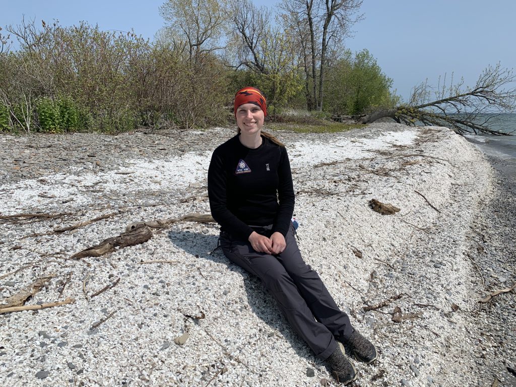
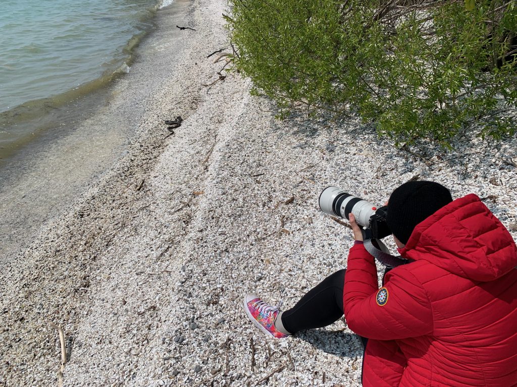
The island is a National Park and is famous for its unique population of snakes that have adapted to the environment in the middle of Lake Ontario. Over the years the snakes evolved to eat Round Gobies, an abundant invasive species in the area. Combined with a lack of predators they have developed gigantism and their numbers have swelled to the point that you meet a snake every few feet. Hiking down the beach made up of broken and bleached Zebra Mussel shells (another invasive species), we had the unique opportunity to capture some awesome images of a large water snake dragging a Goby, which was almost the same size as the snake itself out of the surf and up to the tree line to slowly be eaten.
Kayla on Zebra Mussel BeachJill filming Snakes
As we left the dock and started to follow the setting sun westward back to Point Edward our spirits were riding high from our island experiences which had replaced our disappointment at not exploring beneath the waves.
Cover Photo: Smith Bay, Prince Edward County, Ontario
As I wake up in the county of Prince Edward, Ontario and look out the windows of our small cabin, my heart soars to see the sun rising over the water with a blue cloudless sky and light winds. WOW! It is going to be a perfect day for shipwreck hunting!
So, how do you locate a shipwreck underwater?
We are used to life with cell phones and google maps, you simply enter an address and away you go as it precisely guides you to your destination. My boat is equipped with an advanced chart plotter (GPS for on boats) and sidescan sonar unit. Since the wreck was located by the Fabulous Four over two decades ago you would think that we just need to enter the latitude and longitude and it would guide us directly to the wreck.
Sidescan of SILGO, Shipwreck located in Humber Bay, Toronto
Reality is completely different and the lake loves to keep her secrets!
Twenty years ago, GPS is not what it is today. Originally built for the military it was transitioning in the late 90’s to civilian use and accordingly the accuracy could vary greatly from region to region based on both satellite coverage and the quality of the GPS device you were using.
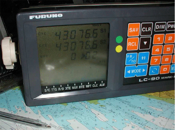
Early GPS Unit
Each of our four shipwreck hunters had their own boats with different types of GPS units. Having plotted the coordinates that each of them gave us on a map, we found they were up to 300 meters apart. On land, with this amount of variation it may take a bit of time but you would ultimately find your target. On the water with the ship hidden 40 meters below it can be like searching for a needle in a haystack.
Paper Readout of Shipwreck
In movies sidescan sonar images always shows the target in beautiful detail. Once again, reality is completely different. Thermocline are changes in water temperature at different depths that can reflect the sonar beams making it look like there is nothing there. Plus when working perfectly there is still an art to reading sidescan imagery. On high resolution passes shipwrecks do show up very clearly but they only reach out a short distance on either side of the boat. Low resolution passes can look further away but lack clarity and detail, hence the art of reading them. So, our plan is to keep our fins crossed and offer a prayer to the sonar gods for successful search!
This website uses cookies for web analytics and marketing purposes. You can block saving cookies to your hard drive at any time, by changing the settings of your web browser. By continuing to use this website without disabling cookies in your web browser you agree to saving cookies to your hard drive.
 The Oliver Mowat Expedition